It's a New Day in Public Health.
The Florida Department of Health works to protect, promote, and improve the health of all people in Florida through integrated state, county, and community efforts.
Hurricane Milton — Local St. Johns County Information
| Oct 07 - Oct 18, 2024 All Day |
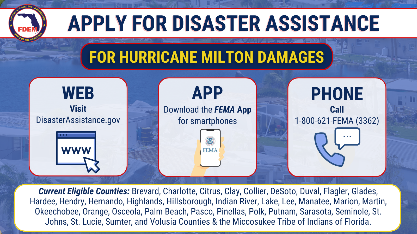
Disaster Assistance
FEMA Individual Assistance
Federal Emergency Management Agency (FEMA) Assistance
Individual Assistance is available to individuals and households needing financial and direct services who have uninsured or underinsured necessary expenses and serious needs. Impacted individuals with insurance are encouraged to apply.
Individual Assistance is available in Brevard, Charlotte, Citrus, Clay, Collier, DeSoto, Duval, Flagler, Glades, Hardee, Hendry, Hernando, Highlands, Hillsborough, Indian River, Lake, Lee, Manatee, Marion, Martin, Okeechobee, Orange, Osceola, Palm Beach, Pasco, Pinellas, Polk, Putnam, Sarasota, Seminole, St. Johns, St. Lucie, Sumter, and Volusia Counties & the Miccosukee Tribe of Indians of Florida. Individuals can apply in multiple ways:
Apply for disaster assistance at DisasterAssistance.gov
Download the FEMA mobile app
Call 800-621-3362 from 7 a.m. to 11 p.m. Eastern Time
Florida homeowners and renters who registered for FEMA disaster assistance after Hurricane Milton should stay in touch with FEMA to ensure the disaster assistance process stays on track.
Survivors should update contact information as soon as possible because FEMA may need to reach them to perform virtual home inspections or get additional information.
FEMA encourages survivors to request direct deposits of disaster assistance to their financial institution. Survivors should let FEMA know as soon as possible of any changes to their banking information.
It’s important to note that FEMA disaster assistance checks cannot be forwarded. If you cannot access your home address, you can request the postal service to hold your mail.
Activate Hope Disaster Assistance Form
Serving as the emergency response arm for the Hope Florida initiative, Activate Hope pulls together the private sector, nonprofits, and government resources to help Floridians get back on their feet following a natural disaster. Activate Hope helps connect Floridians with outside resources to provide food, household goods, home repairs, and more. Fill out the form below to request help today!
SNAP Food Replacement
SNAP Recipients who lost food due to Hurricane Milton can apply for food replacement by completing the form below. To apply, individuals must:
- Be a current SNAP Recipient
- Complete the form by October 19th, 2024.
- Households are required to provide verification of having a power outage of 4 or more hours or damage that caused food loss to their MYACCESS Account, except for households located in Charlotte, Citrus, Collier, Desoto, Flagler, Hardee, Hernando, Highlands, Hillsborough, Lake, Lee, Manatee, Pasco, Pinellas, Polk, Putnam, Sarasota, and Volusia.
- For households in the following counties, complete the online replacement form and upload supporting verification of food loss to your MyACCESS Portal using “Other” as the document type.
- Brevard, Clay, Duval, Glades, Hendry, Indian River, Marion, Martin, Okeechobee, Orange, Seminole, St. Johns, St. Lucie, and Sumter.
- Salvation Army
- Feeding locations: Disaster.SalvationArmyUSA.org/MiltonServiceLocations
- Hotline: 1-800-SAL-ARMY (725-2769)
- Disaster Legal Hotline is open to assist and refer callers. The number is 833-514-2940
- Samaritan's Purse hotline: 1-833-747-1234
- Free Assistance for homeowners affected by the disaster.
- Volunteers may be able to assist with removal of personal property and furniture, flood cleanup, sanitizing with shockwave treatment, chainsaw work & Debris Clean-up, temporary roof tarping.
- 2-1-1 is open and ready to receive calls
- Local Social Services Referral.
- Red Cross Hotline is open to assist survivors: 1-800-Red Cros (733-2767)
- This includes financial, sheltering, reunification, and transitional support.
- Florida Baptists Disaster Relief Public Assistance: 904-253-0502 or text Helene to 27123
- Free Assistance for homeowners affected by the disaster.
- Volunteers may be able to assist with Storm Debris Cleanup, Temporary Roof Tarping, Chainsaw work and Muck outs
- Crisis Cleanup number: 844-965-1386
- Assistance is always free and may include:
- Debris removal
- Tree removal
- Muck & Gut flooded home
- Mold remediation
- & more cleanup assistance
- Assistance is always free and may include:
- Florida Housing Finance Corporation (FHFC) has disaster relief resources and information for Floridians in need of housing options and other housing related support. For more information click here. FHFC has also activated FloridaHousingSearch.org to assist hurricane-impacted Floridians in locating an affordable rental property. This free, statewide search platform is being constantly updated to ensure all listings are accurate. Floridians can also call 1-877-428-8844.
Resources for Business Recovery
SBA Assistance
HURRICANE MILTON SURVIVORS: Business owners and residents in declared disaster areas can now apply for SBA assistance.
Apply in person or online: https://www.sba.gov/funding-programs/disaster-assistance/hurricane-milton
Need help with your application?
Call: (800) 659-2955
Email: disastercustomerservice@sba.gov
Business Emergency Loan Program
Governor Ron DeSantis activated the Florida Small Business Emergency Bridge Loan Program, making $50 million available for businesses impacted by Hurricane Milton. Florida small business owners in need of assistance, including sole proprietors, are encouraged to visit www.FloridaJobs.org/EBL to apply for the Florida Small Business Emergency Bridge Loan Program. The program provides short-term, zero-interest loans to small businesses that experienced economic injury or physical damage due to Hurricane Milton. Interested applicants can apply now through December 4, 2024, or until all available funds are expended.
Health & Safety -
After Milton
The Florida Department of Health urges residents and visitors to stay safe before, during, and after storm events with the following Health & Safety education and information:
- Boil Water Advisory Factsheet
- Carbon Monoxide Safety Factsheet
- Electrical Safety Factsheet
- Flood Water Safety Factsheet
- Food Safety Factsheet
- Helping Children Cope During and After a Disaster Factsheet
- Injury Prevention Factsheet
- Mental Health Factsheet
- Mold Factsheet
- Mosquito Control Factsheet
- Pets and Wildlife Factsheet
- Private Well Water Factsheet
- Septic Tank Factsheet
- Tetanus Factsheet
- Vibrio Factsheet
- Woundcare Factsheet
Prevent Mosquitoes
After hurricanes, Anastasia Mosquito Control District (AMCD) monitors mosquito situations very closely and will take appropriate action when necessary. Also, AMCD emphasizes that residents should empty any containers in their yard that are filled with water to inhibit further mosquito breeding. In addition, wear protective clothing (long sleeves and pants) and insect repellent that contains “DEET” when outdoor
For The Latest Updates
on Milton Recovery Efforts:
In St. Johns County:
![]() Follow St. Johns County Emergency Management
Follow St. Johns County Emergency Management
For the State of Florida:
![]() Florida Division of Emergency Management
Florida Division of Emergency Management
- MILTON UPDATES - Click Here
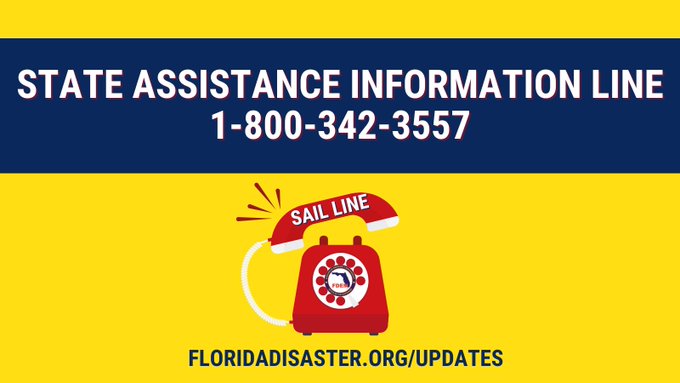
or Call the State Assistance Information Line 1-800-342-3557
📌 This toll-free hotline is activated to provide additional resources to help Floridians receive accurate & up-to-date information. During an emergency, the hotline is operational daily at set hours depending on the severity of the event.
Boil Water Notices:strong
City of St. Augustine
City of St. Augustine Beach
Worker / Cleanup Safety
Take steps to protect yourself and your loved ones during cleanup after a hurricane.
Clean up your home safely.
- Follow CDC Safety Precautions before reentering your flooded home.
- Follow CDC Cleanup Tips and monitor your radio or television for up-to-date emergency information.
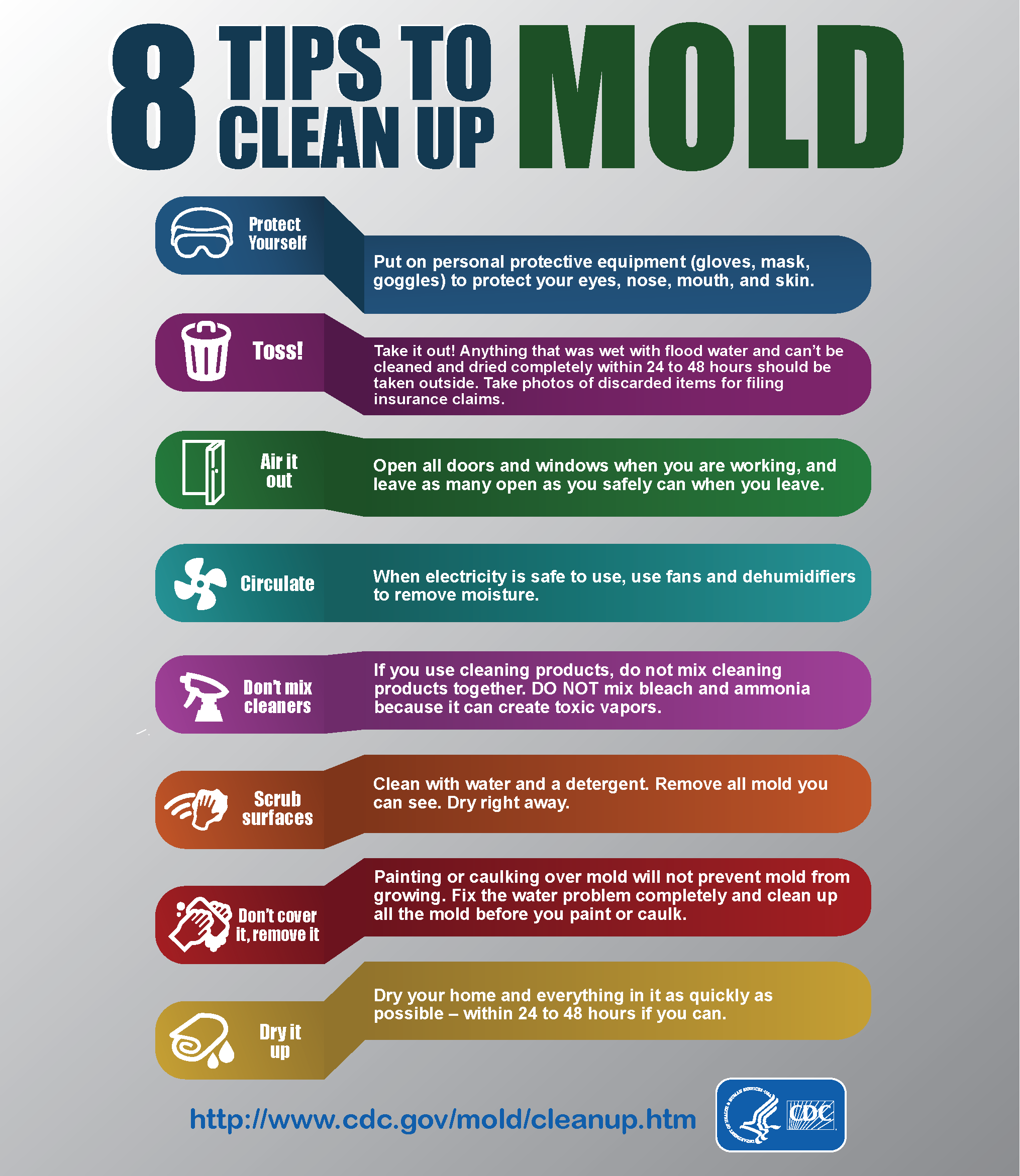
Safely Preventing Mold Growth
- Clean up and dry out the building quickly ( within 24 to 48 hours). Open doors and windows. Use fans to dry out the building. Position fans to blow air out doors or windows.
- Take Steps to PREVENT MOLD GROWTH by Airing out Rooms and Disinfecting.
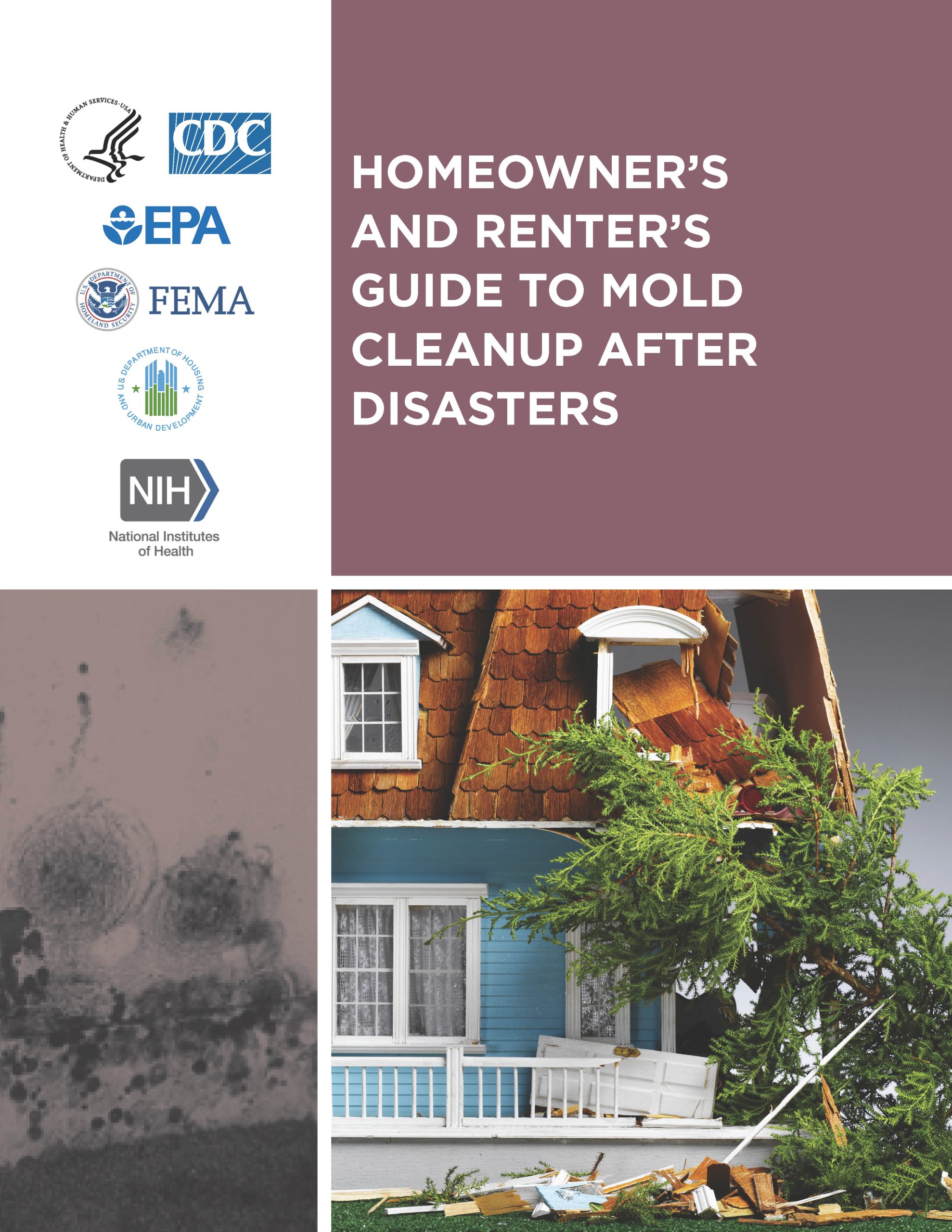
- See the CDC fact sheet for drying out your house, Reentering Your Flooded Home and CDC's Homeowners and Renters Guide to Mold Cleanup After a Disaster.
Homeowner’s and | 8 Tips to |
 |  |
Sewage Potential in Flood Waters
- If your home has been flooded, it also may be contaminated with sewage. See CDC – Floodwater After a Disaster or Emergency.
- If you see raw sewage call DOH-St. Johns Environmental Public Health to report a sanitary nuisance.
Wash your hands.
Good basic personal hygiene and handwashing are critical to help prevent the spread of illness and disease. Clean, safe running water is essential for proper hygiene and handwashing. Hygiene is especially important after an emergency like a hurricane, but finding clean, safe running water can sometimes be hard.
Take care of any wounds or injuries to prevent infection.
The risk for injury during and after a hurricane and other natural disasters is high.
- Get first aid quickly to help heal small wounds and prevent infection.
- Learn more about proper wound care after a disaster.
Take care of your emotional health.
During and after a hurricane, it is natural to experience different and strong emotions. Coping with these feelings and getting help when you need it will help you, your family, and your community recover from a disaster.
- Connect with family, friends, and others in your community.
- Take care of yourself and each other, and know when and how to seek help.
- Learn more on how to take care of your emotional health after a disaster .
How to Volunteer
VolunteerFlorida helps residents and organizations get connected to better assist Floridians in need.
Visit: VolunteerFlorida.org to either register as a volunteer or register your volunteer organization.
Medication Storage Guidance
Put Your Medicines Up and Away and Out of Sight
Approximately 35,000 young children are brought to the emergency room each year because they got into medicines that were left within reach. These emergency visits can be prevented by always putting every medicine up and away and out of children’s reach and sight every time you use it. Are all of your medicines kept somewhere safe?

Families take medications and vitamins to feel well and to stay well. However, any medication, including those you buy without a prescription, can cause harm if taken in the wrong way or by the wrong person. Practicing safe medication storage at home and on the go can help keep children safe. Learn more at www.UpAndAway.org .

Deaf and Hard of Hearing Resources in ASL
- Live Access ASL is a Facebook livestream public group where interpreters provide interpretations for free for inaccessible press conferences and announcements.
- Videos published American Sign Language (ASL) with captions:
Emergency Preparedness for the
Deaf & Hard of Hearing – ASL
- Additional videos published in American Sign Language (ASL) with captions:
- Schedule
- Resources
- Archive
24/7 Be Ready & Stay Informed
St. Johns County Emergency Management has Up-to-Date Local Information
Volunteer Florida: Together We Can #SERVEFL
Report Price Gouging in Florida, Call: 1-866-966-7226
Beware of and Report Fraud and Scams
City of St. Augustine - Hurricane Milton
DOD, FEMA Working in Unison on Hurricane Relief Efforts
Florida Army National Guard - Hurricane Milton Response
Florida Department of Business and Professional Regulation - Hurricane States of Emergency
Florida Department of Children and Families - Hurricane Recovery
Florida Department of Elder Affairs - Disaster Resource Guide for Older Adults
Florida Department of Financial Services - Disaster Information and Resources
Florida Department of Managment Services - Building Closure Information
Florida Department of Military Affairs / Florida National Guard - Natural Disaster Preparedness
Florida Department of Transportation (FDOT) - Toll Suspensions - Hurricane Milton
Florida's Poison Control Centers - Preventing Poisonings After a Hurricane
Florida Public Service Commission
Hope Navigator: Call 1-833-GET-HOPE
Rumor Response: Hurricane Milton - FEMA
St. Johns County Chamber of Commerce - Hurricane Milton Updates
US Army Corps of Engineers - Jacksonville District Website: Hurricane Milton Response
USA.GOV - Find resources to help you recover from the disaster.
October 15, 2024
- ARCHIVE LINKS:
ALERT St. Johns – Emergency Notification System
Evacuation Orders - FloridaDisaster.org
Florida 511 - Realtime Traffic Information
FLHSMV: Driving Safety - Inclement Weather Conditions
Governor Ron DeSantis Press Releases
Price Gouging - Florida Office of the Attorney General
Road-Ready: Emergency Preparedness and Your Vehicle
Shelter Status - Currently Open Shelters for the State of Florida
VA Clinic - Leo C. Chase Jr. in St. Johns County: Operating Status
October 14, 2024
General Guidance
AFTER a Hurricane or Tropical Storm
- Stay Safe After a Hurricane or Other Tropical Storm
- Avoid driving. Roads must be kept clear for emergency vehicles.
- Have valid identification with your current address with you as this may be required at security operations check points.
- If your home has damage, do not reenter until it has been examined by a building inspector for safety.
- Water Precautions - Whenever widespread flooding occurs, there is potential for bacterial contamination. Disinfect any tap water you use for cooking and cleaning. Bring water to a boil for five minutes or use chemicals (eight drops of chlorine bleach or iodine per gallon) or water purification tablets as directed. Continue to do so until official announcement of water safety.
- Throw away food that may be unsafe.
- Prevent carbon monoxide poisoning. Use generators, stoves, and grills outside and away from windows and doors.
- Prevent mold growth; by airing out rooms and disinfecting.
- Beware of snakes, insects, or other animals driven to higher grounds by flooding.
- Avoid downed or dangling utility wires, especially when cutting or clearing fallen trees. Call professionals to remove large uprooted trees.
- After hurricanes, Anastasia Mosquito Control District (AMCD) monitors mosquito situations very closely and will take appropriate action when necessary. Also, AMCD emphasizes that residents should empty any containers in their yard that are filled with water to inhbit further mosquito breeding. In addition, wear protective clothing (long sleeves and pants) and insect repellent that contains “DEET” when outdoors.
Displaced Domestic Animal Hazards
Use Caution After Storms
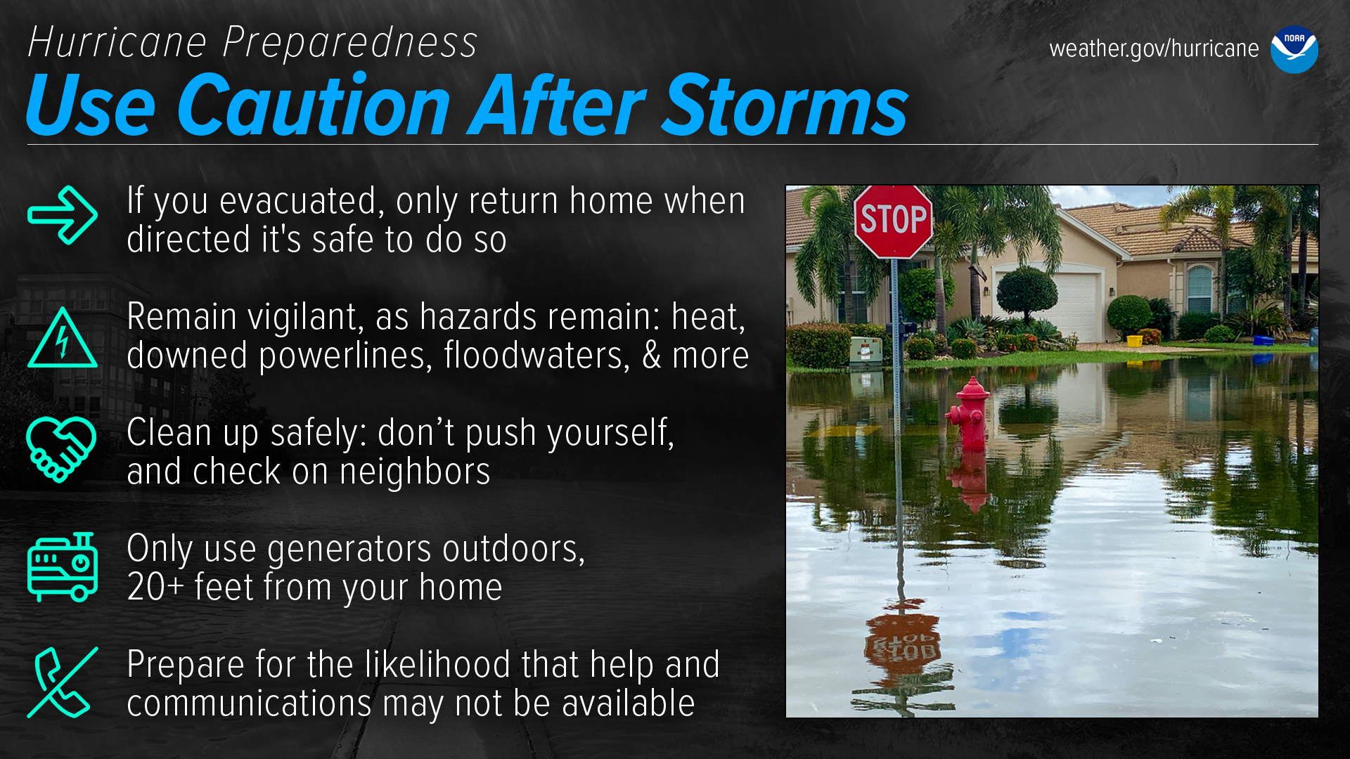
Dangers remain even after the skies turn blue. This is NOT the time to put your guard down. Nearly half of hurricane fatalities occur after the storm.
If you evacuated, only return home only when told to do so
Return home ONLY when officials say it is safe. Check with local officials both where you’re staying and back home before you travel.Remain vigilant, as hazards remain
- Be careful near damaged buildings. Walk carefully around the outside of your home to check for loose power lines, gas leaks, and structural damage, including dangerous debris such as nails or glass. Leave your home if there’s shifting or unusual noises. If you smell gas, get outdoors immediately and call 911.
- Avoid electric shock by staying far away from downed power lines. Stay alert: they may be on the ground, hidden in water, or dangling overhead.
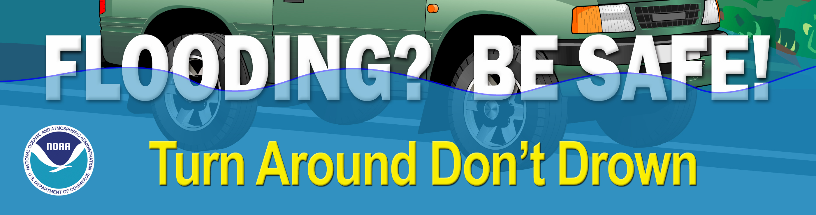
- Flooded roads are very dangerous. It can be difficult to judge how deep or swift the water is moving — just 12 inches of water can float a car. Never drive through flooded roads, even if you are seeking supplies or trying to check on someone. Floods can also compromise bridges and roads. Avoid flooded river areas, as they can continue to rise long after a storm passes.
Don’t walk in floodwaters, either — they can contain harmful bacteria, chemicals, sharp objects, and dangerous animals.Clean up safely: don’t push yourself, and check on neighbors
Stay hydrated, wear light, loose-fitting clothing, and clean up during cooler hours if possible. Don’t push yourself: straining the body can lead to heart attacks, heat strokes, and other serious issues. Perform cleanups slowly, taking lots of breaks. Make sure to check on your elderly neighbors and other vulnerable people in your community. If your area is under a Heat Advisory, use extreme caution and consider cleaning up when the heat has subsided.Practice portable generator safety
Be very careful with portable generators: carbon monoxide poisoning is one of the leading causes of death in areas dealing with power outages. Never use a generator inside your home or garage, even if doors and windows are open. Only use generators outside, more than 20 feet away from your home, doors, and windows.Help and communications may not be readily available
After a hurricane, emergency responders may be overwhelmed. Be aware that it could take hours or days for them to reach your area. Communication systems may be impacted, and making phone or video calls might be difficult due to network congestion. If possible, communicate via text, email, or social media.FDOH Urges Floridians to Avoid Floodwaters and Prevent Exposure to Vibrio Vulnificus
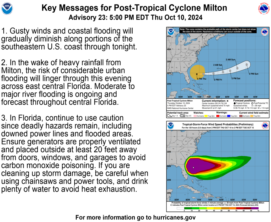
Tuesday, October 8, 2024
Tallahassee, Fla. — The Florida Department of Health (Department) urges residents and visitors to avoid floodwaters and prevent exposure to Vibrio in anticipation of flooding and heavy rain caused by Hurricane Milton. While floodwaters are present, there is an increased risk of Vibrio infections, such as Vibrio vulnificus, which can be life-threatening.
Vibrio bacteria, commonly found in warm coastal waters, can cause illness when ingested or when open wounds are exposed to contaminated water. After heavy rainfall and flooding, the concentration of these bacteria may rise, particularly in brackish and saltwater environments.
What You Need to Know
The Department continues to monitor and respond to health risks posed by Hurricane Milton. For additional emergency information, including the Vibrio vulnificus factsheet, visit FloridaHealth.gov/Emergency or contact your county health department.
- Risk Factors: Individuals who have compromised immune systems, liver disease, or open wounds are at higher risk for Vibrio vulnificus.
- Symptoms: Symptoms may include diarrhea, vomiting, abdominal pain, fever, chills, fast or high heart rate, confusion, or disorientation.
- When to Seek Medical Attention: Seek medical attention immediately if you experience symptoms associated with Vibrio vulnificus, especially after exposure to floodwaters.
- Safety Precautions:
- Avoid swimming or wading in floodwaters, standing water, sea water, and brackish water, if possible.
- Cover open cuts or wounds with waterproof bandages if they could come in contact with floodwaters, standing water, sea water, or brackish water.
- Wash skin and any open cuts or wounds thoroughly with soap and clean water after any contact with floodwaters.
October 12, 2024
Image provided by:
National Hurricane Center
Hurricane and Other Tropical Storm Projected Paths

Power Outage
- NEVER touch a fallen power line.
- Do not drive through standing water if downed power lines are in the water.
- If you believe someone has had electric shock, call or have someone else call 911 or emergency medical help.
- If there has been flooding, have an electrician inspect your home or business before turning on the breaker.

Stay away from power lines.
- Watch out for fallen power lines that may be hanging overhead.
- Stay clear of fallen power lines. Call the electric company to report them.
- Learn more on how to protect yourself from electrical hazards after a disaster.
Never use a wet electrical device.
- Turn off the power at the main breaker in your house if the device is still plugged in. Wait for an electrician to check the device before using it.
- Learn more about electrical safety after a disaster or emergency.
If the power is out,
use flashlights instead of candles.
- If you have to use candles, keep them away from anything that can catch fire. Always stay near lit candles.
- Keep a fire extinguisher handy, and make sure your family knows how to use it. Read the National Fire Protection Association’s tips for using fire extinguishers .
- Learn more about hazards related to power outages.
Keep Your Food Safe
During Power Outages
(YouTube Video Length, 2:07)
Carbon Monoxide (CO) &
Generator Safety
CO is an invisible, odorless and tasteless gas that is very poisonous. It can cause Fatigue, weakness, chest pains for people with heart disease, shortness of breath, stomach pain, vomiting, headaches, confusion, lack of coordination, vision problems, loss of consciousness and in severe cases, death.
Florida Poison Information Center
If a person has collapsed or is not breathing, call 9-1-1 immediately. If you suspect CO poisoning, call the Florida Poison Information Center :
1-800-222-1222.
Highlights
- Generators, grills, camp stoves, or other gasoline, propane, natural gas, or charcoal-burning devices should never be used inside a home, basement, garage, or camper – or even outside near an open window.
- Every home should have at least one working carbon monoxide detector. The detector’s batteries should be checked at least twice annually, at the same time smoke detector batteries are checked.
- Learn more:
Portable Generators can Produce
High Levels of CO Very Quickly
Safety Tips
- Never use a generator indoors, including homes, garages, basements, crawl spaces and other enclosed or partially enclosed areas, even with ventilation. Opening doors and windows, or using fans will not prevent CO buildup in your home.
- Always keep portable generators or gasoline engines outside and away from open windows,
doors, window air conditioners or exhaust vents that could allow CO to come indoors. Follow
the instructions that come with your unit. - Remember, you cannot see or smell CO. If you start to feel sick, dizzy or weak while
using a generator, get to fresh air immediately. - Do not burn charcoal or gas grills inside a house, garage, vehicle, tent or fireplace.
Keep Your Generator |
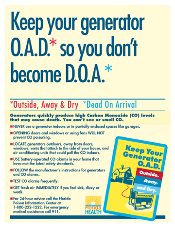 |
CO Alarms Save Lives
- Install battery-operated CO alarms or plug-in CO alarms with battery backup in your home. Follow the manufacturer’s installation instructions. The CO alarms should be certified to the latest safety standards: UL 2034, IAS 6-96, ASTM D6332, or CSA 6.19.01.
- Test your CO alarms—follow the manufacturer’s recommendations and replace dead batteries.
Milton Related News
Thursday, October 10, 2024
- St. Johns County Emergency Management
(Via Facebook Feed)- Storm shelters will close at 10 a.m. on Friday, Oct. 11. Residents who utilized storm shelter services are encouraged to safely return home and assess their property.
While the evacuation order has been lifted, officials urge residents in flood-prone and low-lying areas to proceed with caution. Due to lingering floodwaters, some roads and locations within the community remain impassable. - Effective at 5 p.m. on Thursday, Oct. 10, St. Johns County has lifted the mandatory evacuation order for all of Evacuation Zone A, all of Evacuation Zone B, and the portion of Evacuation Zone F located south of State Road 206.
While the evacuation order has been lifted, officials urge residents in flood-prone and low-lying areas to proceed with caution. Due to lingering floodwaters, some roads and locations within the community remain impassable.
Storm shelters will close at 10 a.m. on Friday, Oct. 11. Residents who utilized storm shelter services are encouraged to safely return home and assess their property. - At approximately 10:30 p.m. on Wednesday, Oct. 9, heavy rains resulting from Hurricane Milton severed a major sewer main at the Anastasia Island Wastewater Facility. St. Johns County Utilities (SJCU) staff promptly responded to the site. St. Johns County assures residents that there WAS NOT and WILL NOT be any interruption to water or sewer services during this process. However, residents are urged to not fish or swim in the Intracoastal Waterway near State Road 312 until water quality testing is completed due to the sanitary sewer overflow.
Once storm conditions allowed, SJCU (SJCU) staff began addressing the situation around 6 a.m. today, Oct. 10. Crews successfully contained the sewer overflow in two stormwater ponds within the facility and manually pumped it directly into the wastewater treatment basins.
Around the same time, SJCU initiated emergency work with a local contractor available to respond. The immediate plan involves installing a temporary sewer main to bypass the sewer flow to the Anastasia Island Wastewater Facility. Crews will work around the clock to expedite the process. Once the temporary bypass is operational, staff will begin restoring the stormwater ponds to their normal operational state.
Following the temporary measures, SJCU will work with a contractor to install a permanent major sewer main to ensure long-term infrastructure integrity.
Call the Citizen Information Hotline at 904-824-5550 with any questions.
- Video of Flagler Estates Flooding, Hurricane Milton, October 10, 9:45AM
- Florida Commerce: If your business was damaged by Hurricane Milton complete the Business Damage Assessment Survey.
- St. Johns County Emergency Management
(Via Facebook Feed)
Visit www.fplmaps.com to view an online, interactive map that lets Florida Power & Light customers view outage and restoration information for their area.
- National Weather Service Jacksonville
(Via Facebook Feed) 8 AM Milton Update- Hurricane Warnings have been changed to Tropical Storm Warnings or a Wind Advisory (see graphic). Tropical storm force winds will continue today mainly along the coast and St. Johns river basin. Be careful around downed trees and powerlines.
 The Storm Surge peak is today for the NE FL & SE GA coast & the St. Johns river basin. Surge impacts will be greatest +/- 2 hrs around high tides.
 A lot of rain fell in the last 24 hours over St. Johns, Flagler, Putnam, and Marion counties. Below is a 24-hr Doppler rainfall total showing 7-12 inches from St. Augustine to Lake George

 Following Hurricane Milton, St. Johns County urges the public to stay off the roads as crews conduct damage assessments across the community.Residents are encouraged to refrain from non-emergency travel until damage assessments are complete. Many roads may be blocked by flooding, debris, or downed power lines, posing hazards to drivers and pedestrians alike. Emergency responders are currently working to clear debris and restore access.For detailed evacuation information, route maps, and updates, visit www.sjcfl.us/hurricane or call the Citizen Information Hotline at 904-824-5550.
 10/10: As Hurricane #Milton continues to move offshore, remain cautious.
Dangerous tropical storm force winds, flooding & storm surge are impacting the East Coast & Central FL throughout the morning.
Avoid flooded areas at all costs & continue to follow all weather alerts
Wednesday, October 9, 2024
- CONSERVE WATER: Heavy rain and storm surge are putting significant pressure on the St. Johns County wastewater system. Conditions are expected to worsen as Hurricane Milton approaches.
We need your help in the next 48 hours to protect our wastewater system and prevent sewer overflows. Please conserve water by avoiding washing laundry, limiting showers, and flushing toilets only when necessary until 5 p.m. Friday, Oct. 11. Every drop you save helps keep our wastewater system healthy during this critical time. Call the St. Johns County Citizen Information Hotline at 904-824-5550 with any questions.
- St. Johns County has launched its Bridge Status Dashboard, which allows the public to view which bridges are currently accessible or inaccessible. Visit www.sjcfl.us/hurricane and click the Bridge Status button near the top of the page to view the dashboard.
October 10, 2024
- Post 10/10/24 5:35 am Cat 1 Milton tracking offshore of FL Space Coast
 Damaging Winds & Storm Surge Impacts continue today for NE FL & coastal SE GA
 Please remain sheltered & follow the guidance of local officialsNever venture into flood waters.Ensure generators are properly placed & ventilated.


October 9, 2024
Be ready to evacuate or stay at home.
Always listen to authorities regarding whether you should evacuate or stay at home.
If a hurricane is coming, you may hear an order from authorities to evacuate (leave your home). Never ignore an order to evacuate. Even sturdy, well-built houses may not hold up against a hurricane. Staying home to protect your property is not worth risking your health and safety.
You may hear an order to stay at home. If driving conditions are dangerous, staying at home might be safer than leaving.
If you need to evacuate:
- Grab your emergency supply kit and only take what you really need with you (cell phone, chargers, medicines, identification like a passport or license, and cash).
- Unplug your appliances. If you have time, turn off the gas, electricity, and water.
- Follow the roads that emergency workers recommend even if there’s traffic. Other routes might be blocked or flooded. Never drive through flooded areas—cars and other vehicles can be swept away or may stall in just 6 inches of moving water.
- Contact your local emergency management office and ask if they offer accommodations for owners and their pets. Learn more about evacuating with your pet.
If you need to stay home:
- Keep your emergency supply kit in a place you can easily access.
- Listen to the radio or TV for updates on the hurricane.
- Stay inside. Even if it looks calm, don’t go outside. Wait until you hear or see an official message that the hurricane is over. Sometimes, weather gets calm in the middle of a storm but then quickly gets bad again.
- Stay away from windows—you could get hurt by pieces of broken glass or flying debris during a storm. Stay in a room with no windows, or go inside a closet.
- Be ready to leave. If emergency authorities order you to leave or if your home is damaged, you may need to go to a shelter or a neighbor’s house.
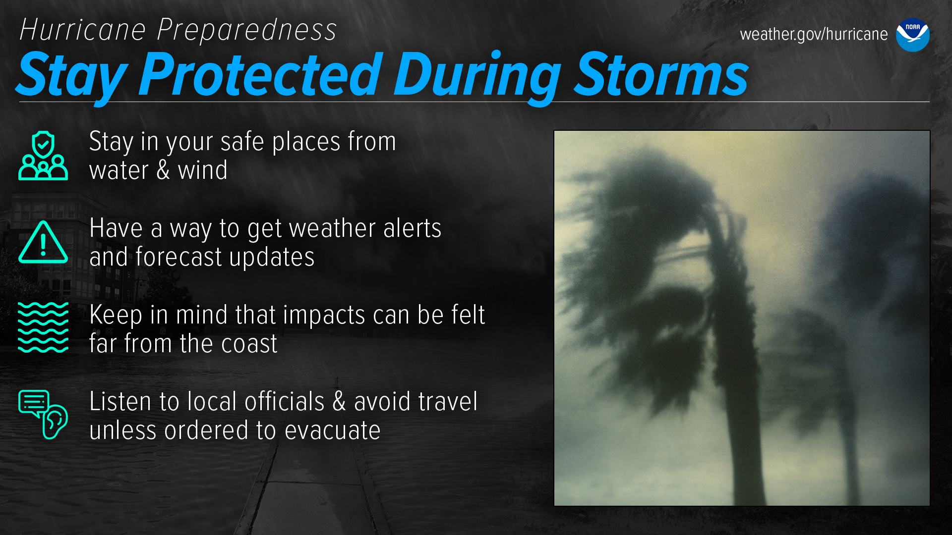
Stay Protected During Storms
During a storm, whether you’ve evacuated or are sheltering in place, know what to expect from the hazards you may face. Remain vigilant, stay up-to-date with the latest forecasts and alerts, and continue to listen to local officials.
Stay in your safe places from water & wind
Always keep a safe distance from flooded and damaged areas. When you’re at risk from storm surge or flooding, it’s important to get to high ground away from bodies of water and any flood-prone areas. Evacuate if told to do so. Never drive through floodwaters or compromised bridges. Always pay attention to barriers and signage.If your house becomes flooded and you’re still there, get higher in your house to escape the flood waters. If the highest floor of your home becomes dangerous, get on the roof and call 911.
Though rain and storm surge cause more direct deaths, wind can also be very destructive and deadly in hurricanes. Winds can be stronger higher above ground level. This can put high-rise buildings at a greater risk. To protect yourself from wind, the best thing you can do is put as many walls as possible between you and the outside. An interior room without windows is the safest place you can be in a building. You can cover yourself with a mattress and wear a helmet for added protection. If your area is under an Extreme Wind Warning, take shelter immediately. Make sure to stay sheltered until the threat is gone.
Have a way to get weather alerts and forecast updates
Make sure to have Wireless Emergency Alerts enabled on your phone to receive Warnings and other alerts. Always pay attention to the latest forecast as conditions can change quickly and storms can rapidly intensify from a tropical storm to a major hurricane. Even small changes in the storm’s track can make a big difference.Keep in mind that impacts can be felt far from the coast
Remain vigilant even if you’re far from the most damaging winds. Inland flooding can be felt hundreds of miles from the coast. Never drive through floodwaters! A car can be swept away with only a foot of water, and there’s no way to know if the road itself has collapsed when hidden by water.Listen to local officials & avoid travel unless ordered to evacuate
Local officials can provide you with up-to-date information as the situation changes in your area. Evacuation orders may still be given at this late stage — leave immediately if ordered! Follow recommended evacuation routes — do not take shortcuts, as they may be blocked. Be alert for road hazards such as washed-out roads or bridges and downed power lines. Never drive through floodwaters.
- Governor Ron DeSantis: Issues Updates on State Preparedness Efforts for Hurricane Milton
- Uber Providing Free Rides to Shelters: The State of Florida has partnered with Uber to provide residents in mandatory evacuation zones free rides to a local shelter. To get a ride, residents should: open the Uber app, tap Account on the bottom right and tap Wallet, and add promo code MILTONRELIEF
- St. Johns County Emergency Management
St. Johns County has issued a mandatory evacuation order for: all residents and visitors in Evacuation Zone A (ALL OF ZONE A, which includes coastal and river areas), Zone B (ALL OF ZONE B), and Zone F (ONLY the part south of State Road 206) effective at 8 a.m. on Wednesday, Oct. 9, due to the imminent threat posed by Hurricane Milton.

This includes the entire City of St. Augustine, the City of St. Augustine Beach, and residents living on waterfront properties or in flood-prone areas. Residents living in boats, RVs, mobile homes, and low-lying flood-prone areas are also required to evacuate.
For detailed evacuation information, route maps, and updates, visit www.sjcfl.us/hurricane or call the Citizen Information Hotline at 904-824-5550.
- US National Weather Service Jacksonville Florida


 𝟏𝟎/𝟗/𝟐𝟎𝟐𝟒 𝟏𝟏𝐚𝐦 𝐀𝐝𝐯𝐢𝐬𝐨𝐫𝐲Hazards: damaging winds, storm surge, flooding, river flooding & dangerous beach/marine conditions
Stay Informed
Receive alerts about emergencies by signing up for the
St. Johns County Emergency Notification System:
Additional Resources:
- DOH-St. Johns Emergency Preparedness and Response
- FloridaDisaster.org – Division of Emergency Management
- National Hurricane Center
- National Weather Service - Jacksonville FL
- NOAA Weather Radio
- St. Johns County Emergency Management
Get Moving When a Storm Threatens

When a storm is forecast to impact your area, take action immediately to be ready. Ideally, longer-term preparedness actions such as having disaster supplies and an evacuation plan will have already been done before hurricane season, when the stores are stocked and time is on your side. When a storm threatens, there’s a lot more to do.
Protect your home
While longer-term home improvement needs to be done well ahead of time, when a storm threatens there are short-term actions to help protect your property. Board up windows, secure loose outdoor items, and secure all exterior doors. Move your vehicle to a safe location if you’re not using it to evacuate. If you are evacuating, unplug electrical equipment such as radios, televisions and small appliances (freezers and refrigerators also need to be unplugged if there is a risk of flooding). If you are instructed to do so, shut off water, gas and electricity before leaving.Determine sheltering options & consider your pets
Check with local officials to find out what shelter spaces are available. If you have pets, find a place where they can stay — most public shelters only allow service animals. In general, have multiple sheltering options, including distant ones such as a friend’s home outside of the impact area, or a motel. Depending on the circumstances, your home may need to be your shelter — make sure it is prepared and that you know the safest places inside.Ready your go-bag, medications & supplies, charge phone, fill up/charge vehicle
Have a go bag ready to take things with you if you need to leave in a hurry. In addition to basic survival needs, don’t forget other supplies such as chargers and hygiene products. Plan to have enough for at least three days, and don’t forget about your pets. While preparing these basic needs, don't forget to keep your phone charged, and make sure to fill up/charge your vehicle as well.
Your go-bag should also contain important personal and property documents, including your written communication plan.Help your neighbors, especially the elderly & other vulnerable people
Many people rely on their neighbors before and after a disaster, and there are many ways you can help them. Help them prepare for a storm, and help them evacuate if needed. Share the latest forecast information with your community so that they know what to expect.Follow evacuation orders if given
Always follow evacuation orders from local authorities — don’t wait for a hurricane to intensify before deciding to follow the order. You want to leave early enough to avoid being trapped by severe weather. If time allows, unplug electrical equipment, leave a note detailing your whereabouts, and check to see if any neighbors need a ride.

October 8, 2024
Tuesday, October 8, 2024
Council on Aging Storm Closures – Wednesday, October 9, and Thursday, October 10, 2024
Florida Highway Patrol's - Live Traffic Crash and Road Condition report.
- Florida Department of Transportation
- Use Florida 511 for real-time traffic information
- Emergency Shoulder Use (ESU) has been activated. View ESU Routes here.
- Toll Suspensions: Governor Ron DeSantis announced that he has directed the suspension of tolls across Central Florida and West Florida, as well as Alligator Alley, in preparation for Hurricane Milton. View the Toll Suspension Map.
- Florida Army National Guard: Hurricane Milton Preparation
- Governor Ron DeSantis: Issues Updates on State Preparedness Efforts for Hurricane Milton
- USGS: The latest science and information related to Hurricane Milton.
- USA.GOV: Learn how the U.S. government is responding to Hurricane Milton. Find resources to help you recover from the disaster.
- US Department of Defense: While Engaged in Helene Relief Efforts, DOD Prepares for Hurricane Milton
- FEMA: Milton is a dangerous storm. Take action now. Follow directions from your local officials and leave immediately if told to evacuate.
Storm Shelters Opening
Three storm shelters will open at 8 a.m. on Wednesday, Oct. 9, to accommodate evacuees:
• Special Medical Needs: Freedom Crossing Academy, 1365 Shetland Drive, St. Johns• Pet Friendly: South Woods Elementary School, 4750 State Road 206 West, Elkton• General Population: Pedro Menendez High School, 600 State Road 206 West, St. AugustineResidents who require transportation to a storm shelter should call the Emergency Management Citizen Information Hotline at 904-824-5550. Transportation will be provided for those in need.
Supplies Needed
While shelters provide safety throughout the storm, residents must bring supplies to maintain personal comfort. St. Johns County recommends that all evacuees bring their own bedding, including sleeping bags or air mattresses, pillows, sheets, and blankets. A five-day supply of water, non-perishable food, medication, diapers, and other personal items are also suggested.
Please refer to the list below for additional supply suggestions.• At least a five-day supply of medications, insulin, and a cooler if you are diabetic• Personal grooming and hygiene items, feminine supplies• Extra clothing, eyeglasses• Books, magazines, cards, games, etc.• Pillows, blankets, sheets, lawn chair/chaise lounge• Flashlight and extra batteries, manual can opener• Personal identification/important papers- Not sure which evacuation zone you live in? Head to sjcfl.us/hurricane to find out!
St. Johns County has also issued a mandatory evacuation order for all residents and visitors in Evacuation Zone A (ALL OF ZONE A, which includes coastal and river areas), Zone B (ALL OF ZONE B), and Zone F (only the part south of State Road 206) effective at 8 a.m. on Wednesday, Oct. 9, due to the imminent threat posed by Hurricane Milton. This includes the entire City of St. Augustine, the City of St. Augustine Beach, and residents living on waterfront properties or in flood-prone areas. Residents living in boats, RVs, mobile homes, and low-lying flood-prone areas are also required to evacuate.
Residents in these evacuation zones who do not intend to utilize a St. Johns County storm shelter should leave as soon as possible to avoid unexpected traffic delays.
- St. Johns County Emergency Management
(Via Facebook)
As part of St. Johns County's emergency preparedness efforts, a Special Medical Needs Storm Shelter will open at 8 a.m. on Wednesday, Oct. 9, at Freedom Crossing Academy, located at 1365 Shetland Drive, St. Johns. This shelter is specifically designed for individuals with medical needs that cannot be accommodated in a general population shelter. St. Johns County has issued an evacuation order effective at 8 a.m., Wednesday, Oct. 9, for all of Evacuation Zone A, all of Evacuation Zone B, and the part of Evacuation Zone F that is south of State Road 206.
Not all individuals are eligible to utilize the Special Medical Needs Storm Shelter. Space is reserved for those who rely on electricity for medical equipment or require oxygen therapy.
The Special Medical Needs Storm Shelter is not a substitute for regular health care. Basic medical assistance and monitoring will be available, but individuals must come with a caregiver to ensure they maintain their accustomed level of care. Shelter staff will not be able to provide one-on-one care.
The Special Medical Needs Storm Shelter is not equipped with advanced medical equipment and is not staffed to provide advanced levels of care. Individuals requiring advanced care, such as hospital beds, dialysis, ventilators, tracheostomy care, or Hoyer lifts, should discuss alternative sheltering arrangements with their caregivers or healthcare providers before evacuating.
If ambulance transportation or access to hospital facilities is needed, individuals or their caregivers should make those arrangements in advance, as the Special Medical Needs Storm Shelter is not a hospital.
Be Prepared Before the Storm
The Florida Department of Health supports local and state responses to public health needs resulting from hurricanes, tropical storms, and other severe weather conditions.
Remember that severe weather can impact your access to power and water. Driving might not be possible after the storm - your car might be damaged and roads may be flooded or blocked.
- Prepare any supplies you may need to keep your loved ones safe and healthy before and after the storm.
- Listen to local authorities regarding evacuations. Don’t return home until local officials notify you it’s safe to do so.
Download the
2024 St. Johns County
Hurricane Preparedness Guide
(PDF, 15.5MB)
Additional Downloads:
Please visit DOH-St. Johns — Hurricane Resources to find out more about hurricane preparedness resources in St. Johns County.
Gather emergency supplies.
During and after a hurricane or other tropical storm, you may need supplies to keep your family safe and healthy. Remember that a hurricane or tropical storm could cut off your power and water supply. You also may not be able to drive because of damage to your car. Roads may be flooded or blocked.
That’s why it’s best to be prepared—stock up on everything you might need now. Be sure to prepare the following:
- An emergency food and water supply.
- An emergency medicine supply.
- Emergency power sources such as flashlights (don’t forget extra batteries).
- Safety and personal items.
- Important documents, including medical documents, wills, passports, and personal identification.
- A fire extinguisher. Make sure your family knows where to find it and how to use it! Read the National Fire Protection Association’s tips for using fire extinguishers.
Know the difference between a hurricane or tropical storm “watch” and “warning.”
Listen for National Weather Service alerts on TV or radio or check for them online. There are two kinds of alerts:
- A hurricane watch means hurricane conditions (sustained winds of 74 miles per hour [mph] or higher) are possible in a stated area. Experts announce hurricane watches 48 hours before they expect tropical-storm-force winds (sustained winds of 39 to 73 mph) to start.
- A hurricane warning is more serious. It means hurricane-force winds are expected in a stated area. Experts issue these warnings 36 hours before tropical-storm-force winds are expected in the area to give people enough time to prepare for the storm.
For more information about hurricane watches and warnings, check out the National Weather Service’s Hurricane Center. If you hear that there is a hurricane or tropical storm watch or warning in your area, you can take steps to get ready.
Get your car ready.
Make sure your car is ready before the storm hits.
- Fill your car’s gas tank.
- Move cars and trucks into your garage or under cover.
- Always keep an emergency kit in your car.
- Visit Ready.gov for information on how to prepare your car and what to include in your kit.
If you don’t own a car, consider making plans with friends or family or call authorities to get a ride if you need to evacuate.
Get your family and pets ready.
- Go over your emergency plan with your family.
- Keep checking for updates about the storm. Watch TV, listen to the radio, or check online.
- Call the hospital, public health department, or the police about special needs. If you or a loved one is older or disabled and won’t be able to leave quickly, get advice on what to do.
- Put pets and farm animals in a safe place. Read more about pet safety during an emergency.
Get your home ready.
- Clear your yard. Make sure there’s nothing that could blow around during the storm and damage your home. Move bikes, lawn furniture, grills, propane tanks, and building material inside or under shelter.
- Cover up windows and doors. Use storm shutters or nail pieces of plywood to the outside window frames to protect your windows. This can help keep you safe from pieces of shattered glass.
- Be ready to turn off your power. If you see flooding, downed power lines, or you have to leave your home, switch your power off.
- Fill clean water containers with drinking water. You’ll want to do this in case you lose your water supply during the storm. You can also fill up your sinks and bathtubs with water for washing.
- Check your carbon monoxide (CO) detector’s battery to prevent CO poisoning.
Download the
2024 St. Johns County
Hurricane Preparedness Guide
(PDF, 15.5MB)
Please visit Florida Department of Health in St. Johns County — Hurricane Resources to find out more about hurricane preparedness resources in St. Johns County.
Take Action Today
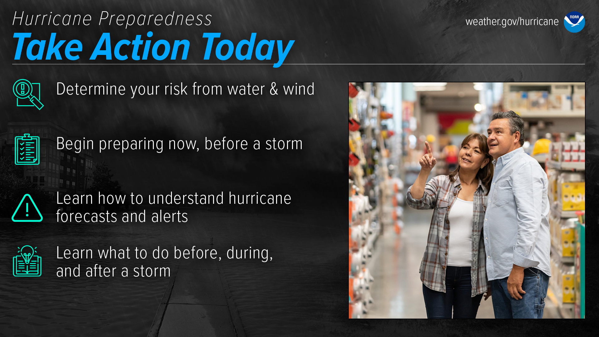
Are you ready for hurricane season? Take action TODAY to be better prepared for when the worst happens. Understand your risk from hurricanes, and begin pre-season preparations now. Make sure you understand how to interpret forecasts and alerts, and know what to do before, during, and after a storm. Even if you are already well-prepared and knowledgeable, there may be additional things you could do or learn to be even more prepared.

-


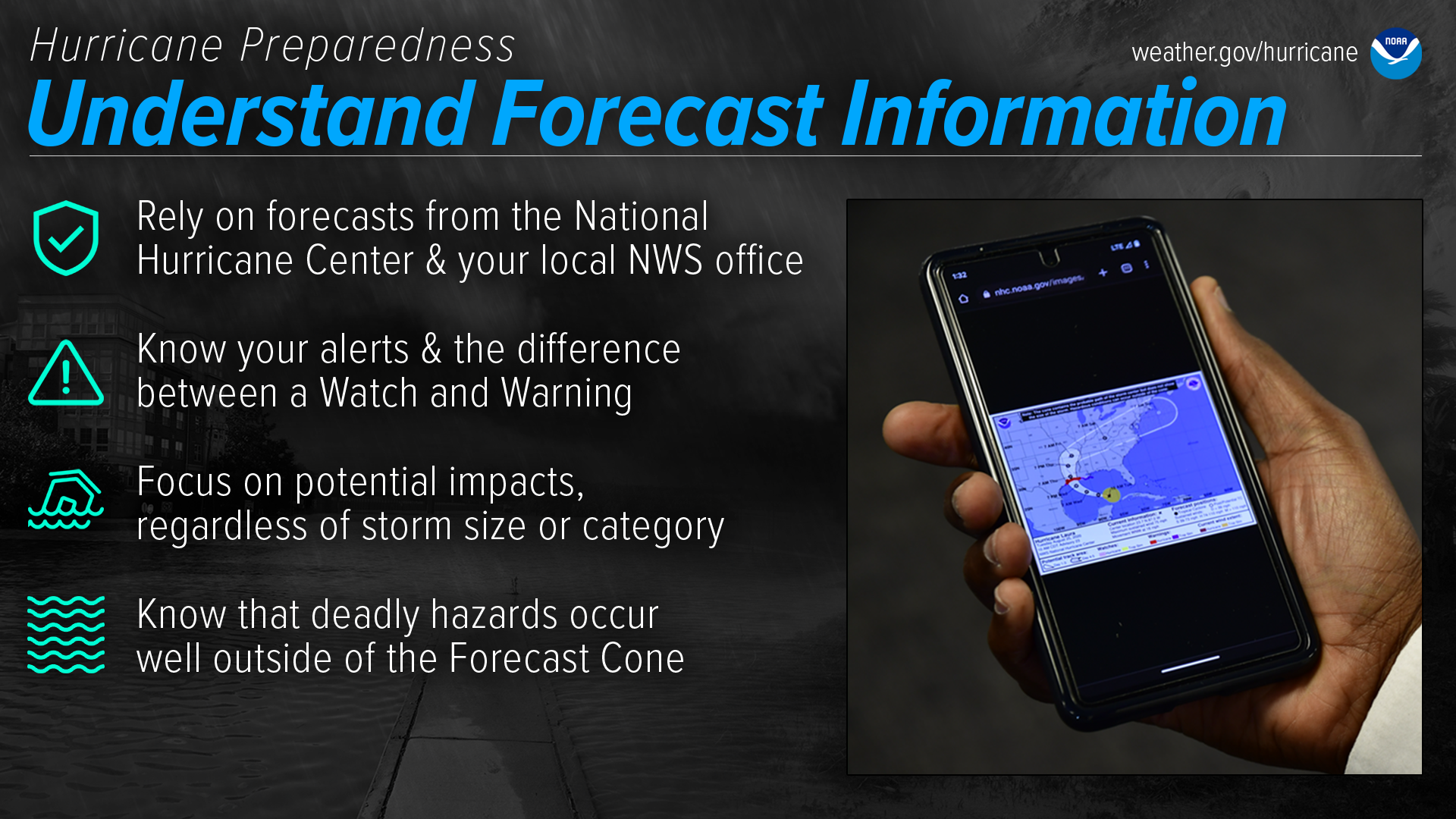
Understand Forecast Information
National Weather Service forecast products can tell you a lot about what is expected to happen with a storm, including the storm’s paths, rainfall amounts, wind speeds, and more. There is a lot of information available days ahead of a storm, and it is important to understand what it means.
Have trusted sources for storm information
Rely on official forecasts and well-established media partners in the Weather Enterprise. Be cautious of sensational headlines and instead look for reliable sources to determine a storm's potential impacts. Use the official National Hurricane Center Forecast — their hurricane specialists access a variety of data (models, aircraft, satellite) to make the most accurate forecasts possible. Meteorologists at local NWS offices understand which locations in your area are most vulnerable to storm surge, flooding, and wind. Always check to make sure you have the latest forecast information. Make sure to have Wireless Emergency Alerts enabled on your phone to receive Warnings.Know your alerts & the difference between a Watch & Warning
In general, a Watch means impacts are possible; a Warning means impacts are expected or happening. Different hazards and alerts require different responses:- A Hurricane Watch means hurricane conditions are possible somewhere within the watch area, with tropical-storm-force winds beginning within the next 48 hours. Prepare by boarding up windows and moving loose items indoors, and make sure your emergency kit is ready. A Hurricane Warning means hurricane conditions are expected somewhere within the warning area, with tropical-storm-force winds beginning within 36 hours. Seek shelter in a sturdy structure or evacuate if ordered.
- A Tropical Storm Watch means tropical storm conditions are possible within the next 48 hours, a Tropical Storm Warning means they are expected somewhere within the warning area. Remember, a tropical system does not have to reach hurricane strength to be deadly.
- A Storm Surge Watch means the possibility of life-threatening inundation generally within 48 hours, and a Storm Surge Warning means the danger of life-threatening inundation generally within 36 hours. In either case, please promptly follow evacuation and other instructions from local officials.
- An Extreme Wind Warning means extreme hurricane winds (115 mph+) are imminent or happening: take immediate shelter in an interior portion of a well-built structure.
- A Flash Flood Warning means dangerous flash flooding is expected: move to higher ground, and never walk or drive through floodwater. A Flash Flood Emergency is issued for exceedingly rare situations when a severe threat to human life and catastrophic damage is happening or about to happen — do NOT attempt to travel unless you are under an evacuation order or your life is imminently at risk.
- A Flood Watch means flooding is possible: stay tuned to trusted news sources and be ready to seek higher ground. A Flood Warning means flooding is happening or about to happen: move to higher ground immediately.
- A Tornado Watch means a tornado is possible: know your safe place and be ready to act quickly if a Warning is issued. A Tornado Warning means a tornado is happening or about to happen - immediately seek shelter in your safe place!
Focus on potential impacts regardless of storm size or category
Do not focus on a specific storm category; all hurricanes and tropical storms can bring life-threatening storm surge, inland flooding, and damaging winds. The storm's scale only tells you about the strongest winds near the center of the storm and does not tell you about potentially life-threatening flooding from storm surge or rain. Remain vigilant even if the winds have weakened and the storm becomes a lower category or tropical storm — rainfall and storm surge impacts often continue.Deadly hazards occur well outside of the cone
Impacts can be felt far from the storm's center, even well inland and outside the Forecast Cone. Remember: the storm itself can stretch well beyond the Forecast Cone, and so can the impacts.The National Hurricane Center Forecast Cone shows the probable forecast track of the center of the storm. This means that the storm’s center will probably travel somewhere within the cone’s boundaries. (Historically, the storm’s center has remained within the forecasted cone roughly two-thirds of the time.) The cone does NOT represent the size of the storm in any way.
- A Hurricane Watch means hurricane conditions are possible somewhere within the watch area, with tropical-storm-force winds beginning within the next 48 hours. Prepare by boarding up windows and moving loose items indoors, and make sure your emergency kit is ready. A Hurricane Warning means hurricane conditions are expected somewhere within the warning area, with tropical-storm-force winds beginning within 36 hours. Seek shelter in a sturdy structure or evacuate if ordered.
October 7, 2024
Governor DeSantis Provides Update #3 on Hurricane Milton at State Emergency Operations Center
- (via St. Johns County Facebook Feed)


October 6, 2024
St Johns EOC
(via St. Johns County Facebook Feed)- Under EO 24-215, residents who rely on prescription medication can get early refills regardless of typical limits. If you're in a county under a State of Emergency for Hurricane #Milton, the time is NOW to utilize early prescription refill access.
- Check out these important preparations tips and be sure to follow St. Johns County Emergency Management as we prepare for Milton. More messaging to come.

Sandbag Pickup Locations:
- Windswept Acres Park - 5335 SR A1A South, St. Augustine
- Solomon Calhoun Center - 1300 Duval Street, St. Augustine
- County Equestrian Center - 8200 Smith Road, Hastings
- Mills Field - 1805 Racetrack Road, St. Johns
- North Beach Park - 3721 Coastal Highway, Vilano Beach
- Palm Valley Bridge - East Side of Intracoastal Waterway

October 5, 2024
MEMORANDUM: EXECUTIVE ORDER NUMBER 24-214 (Emergency Management – Tropical Storm Milton)
Early Prescription Refills Permitted Under State of Emergency
This notice is a reminder that all health insurers, managed care organizations, and other health entities must comply with provisions of section 252.358, Florida Statutes, which allows early prescription refills in the event the Governor issues an Executive Order declaring a State of Emergency. This mandate remains in effect until the Governor’s Executive Order is rescinded or expires.
Prescription Information
Under a State of Emergency, a pharmacist may be able to refill prescriptions early. In accordance with section 465.0275, F.S., pharmacists may dispense up to a 30-day supply of maintenance medication for a chronic condition. However, a 30-day prescription for a medicinal drug listed in Schedule II appearing in chapter 893 is not permitted under section 465.0275, F.S.
In the event a pharmacist receives a request for a prescription refill and are unable to obtain refill authorization from the prescriber, the pharmacist may dispense a one-time emergency refill of up to a 72-hour supply of the prescribed medication; or a one-time emergency refill of one vial of insulin to treat diabetes mellitus, irrespective of the issuance of an executive order.
Featured Programs

Connect with DOH